
As part of a recent Phase II Environmental Site Assessment (ESA) for a property sale, Westward conducted a drone magnetics survey across approximately 130 acres in Central Texas to investigate the location of abandoned oil and gas wells on the property.
Historical records identified four previously plugged wells and one unplugged well, identified as Well #06, at the site. While a well report existed for #06, its recorded location was not precise enough to physically locate the well on the ground. The client called on Westward to conduct a drone magnetics survey to help narrow the search area.
Westward conducted the survey using a DJI Matrice 400 equipped with a MagArrow II magnetometer. The aerodynamic, self-contained instrument measures variations in the Earth’s magnetic field from the air, allowing buried metallic objects and other magnetic anomalies to be identified. The MagArrow II uses two laser-pumped atomic cesium-vapor sensors positioned at right angles to one another within its aerodynamic shell to measure the surrounding magnetic field.
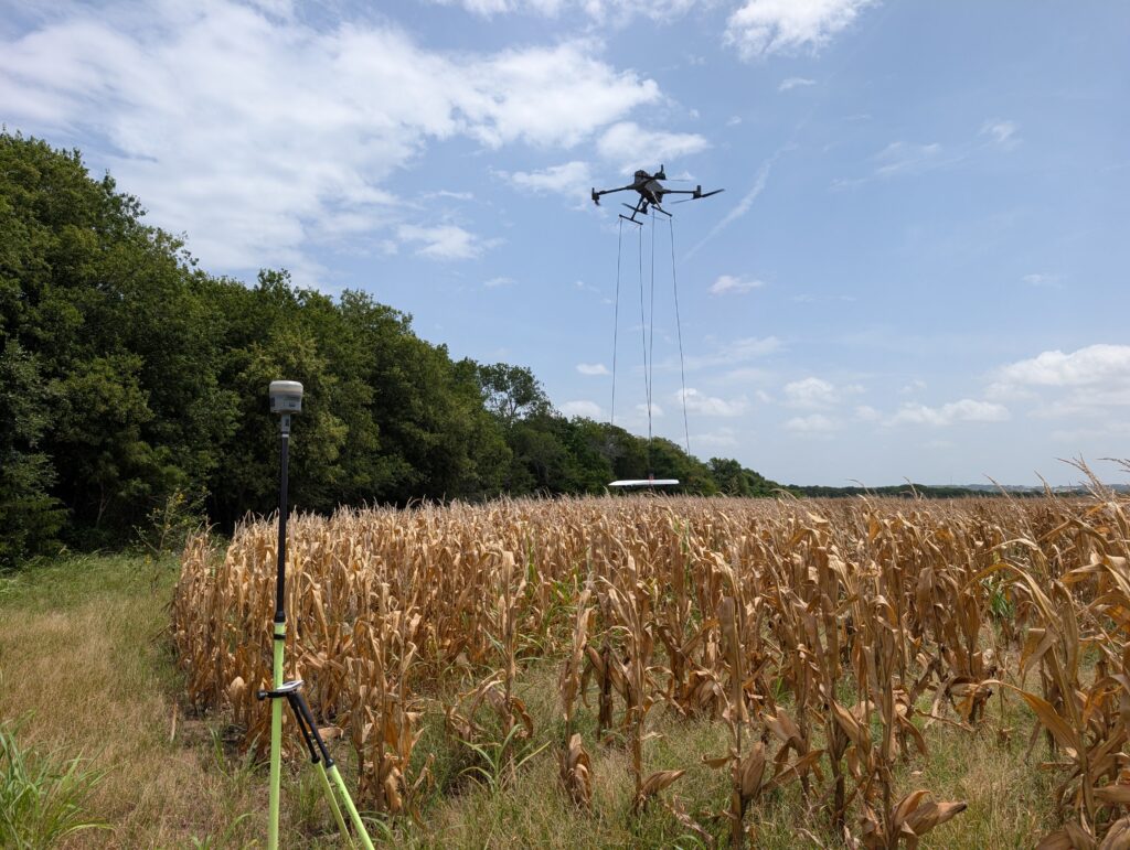
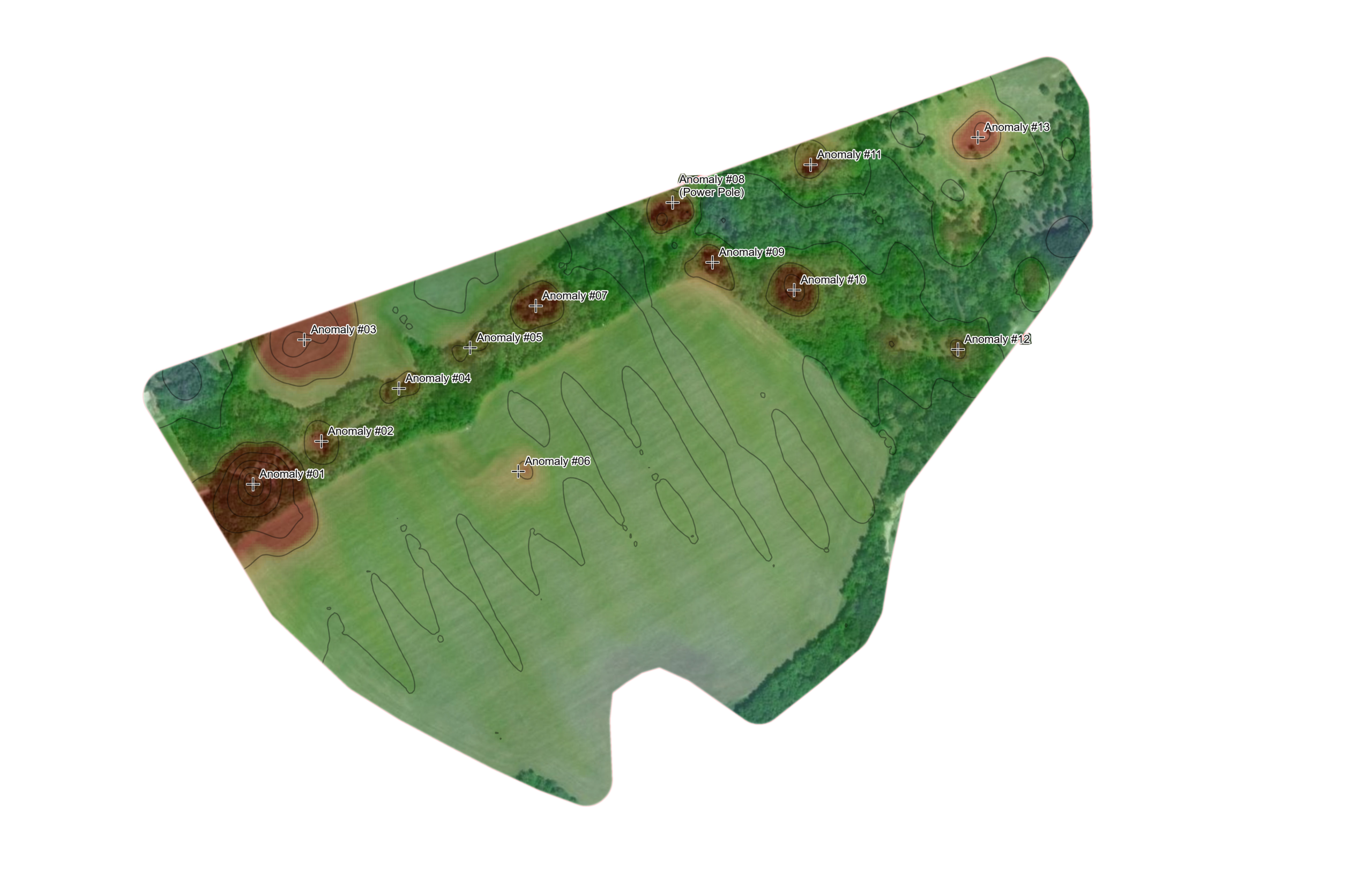
The initial survey was flown at approximately 100 feet above the 130-acre site. The resulting data identified multiple magnetic anomalies, including the four known plugged wells and an anomaly associated with the approximate recorded location of Well #06.
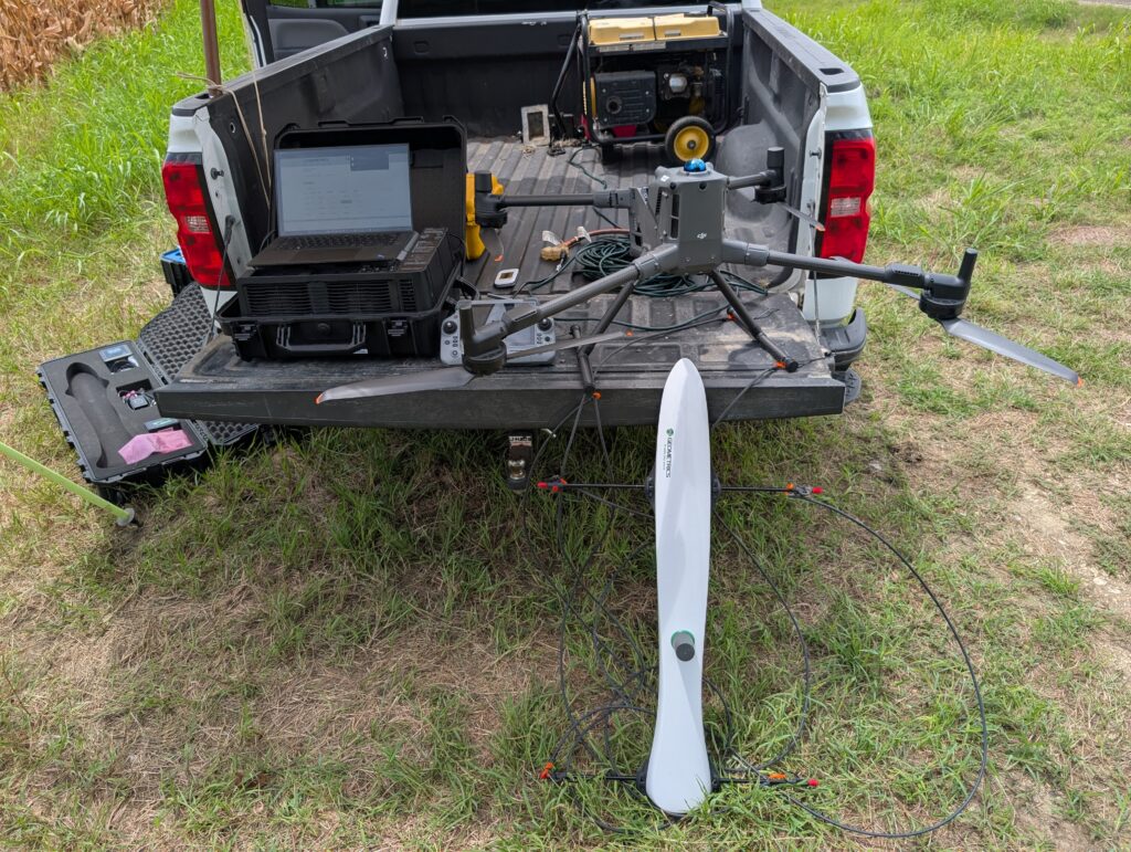
Westward then conducted a second, more focused flight over the area at approximately 20 feet. Flying closer to the surface provided higher-resolution magnetic data and allowed the team to further refine the location of the well.
Abandoned Wells and Environmental Due Diligence
The issue is particularly significant in Texas, where more than 12,000 orphaned oil and gas wells remained as of April 2026. The Railroad Commission of Texas reported Sept. 30 that it plugged a record 2,022 orphaned wells during fiscal 2026, exceeding its legislative target by 300 wells, at a cost of approximately $125.6 million. Nationally, the U.S. Environmental Protection Agency estimated in 2023 that approximately 3.7 million abandoned and orphaned wells exist across the country. While Texas is making significant progress, the scale of the problem underscores the continuing need to locate legacy wells, assess potential environmental risk, and address contamination that may remain even after plugging.
Abandoned wells that are no longer used for oil and gas production are generally expected to be properly plugged when taken out of service. However, some older wells recorded as plugged may not have been abandoned to current standards or may have deteriorated over time, potentially creating pathways for subsurface or surface contamination. Drone
magnetics can be useful in locating both unplugged wells and older plugged wells when their precise locations are uncertain.
For property owners, developers and prospective buyers, older wells can also present a practical due diligence challenge. Decades of agricultural use, development, weather and other physical changes to a property can remove visible evidence of a well, while older records may not provide coordinates precise enough to locate it using conventional methods.
Another Tool for Site Investigation
Drone magnetics provides another method for investigating sites where abandoned wells or other buried features may be present. It can efficiently cover large areas, identify and map magnetic anomalies, and help environmental professionals focus on follow-up investigations where it is most needed.
The technology does not determine what every anomaly represents, making historical research and field verification important parts of the process. In this case, combining historical well records with drone magnetics allowed Westward to narrow the location of Well #06 and give the client a clear location for ground-truthing and eventual plugging. The survey also identified other buried metallic objects that may warrant additional investigation.
For properties with incomplete or imprecise historical records, drone magnetics can help turn uncertainty about what may be below the surface into actionable information, helping property owners and environmental professionals determine where to investigate next and make better-informed decisions about a site.